Log in
All resources
Create a design
2,799 Free Artworks of Latin Language
bibliothèque nationale de france
latin-language maps
mappa geographica novissima regni hungariae, - divisi in suos comitatus cum districtibus jazygum et cumanorum banatus temesiensis ejusque districtuum nec non regnorum croatiae sclavoniae dalmatiae magni... - btv1b532332906
tranquillo mollo
philippe de la rué
latin-language words and phrases
1744 fleurons
navigantium atque itinerantium bibliotheca
latin-language mottos
maps by emanuel bowen
john rocque's 1748 map of london and adjacent country
bibliothèque nationale de france
brabantia ducatus - tabula ducatus brabantiae continens marchionatum sacri impery et dominium mechliniense - magna cura edita a petri verbist - btv1b53042443n
bibliothèque nationale de france
brabantia ducatus - tabula ducatus brabantiae continens marchionatum sacri impery et dominium mechliniense - magna cura edita a petri verbist - btv1b53042443n
bibliothèque nationale de france
beschrijvinge vande uuterste omlopende custe van iudtlandt aen weder zijden op de belt ende noortzee, in zijn wesen ende gedaente tusschen aelburger diep ende rijncopen - lucas ioannes aurigari(us) autore... - btv1b53235832k
bibliothèque nationale de france
beschrijvinghe van de zee custen van vlanderen, ende picardien, beghijnnende van nijeupoort tot diepen, met de vlaemsche bancken, begrepen de engte tusschen engelandt ende vranckrijk, twelckmen de hooffden... - btv1b53211568c
bibliothèque nationale de france
de custe van noorweghen, met dat landt van noordt oosten in zijne wesen ende gedaente soe hem dat verthoont ende op doet van mardou tot akersondt - (lucas ioannes aurigarius inventor) ; io(ann)es à... - btv1b53235850h
bibliothèque nationale de france
beschrijvinge vande vermaerde stroemen, t vlie ende t maersdiep ; opstreckende inde zuijder zee voer bij enchuijsen tot amstelredam, met alle de sanden plaeten ende ondiepten op de selve stroemen gheleghen... - btv1b532255737
bibliothèque nationale de france
maps by emanuel bowen
1744 fleurons
jan diricks van campen
johannes van wick
maps of the ottoman empire by mercator-hondius
ottoman empire in the 1600s
maps of ancient israel by philippe de la rué
old maps of the tribes of israel
17th-century maps of the strait of magellan
1640 maps of south america
maps of the ottoman empire by mercator-hondius
map
philippe de la rué
maps of mysia
17th-century maps of lorraine
bussemacher (surname)
josef anton selb
quackery in art
wilhelm pleydenwurff
hartmann schedel
maps by emanuel bowen
1744 fleurons
verthoninghe van de zee custen van bretaignen ; soe hem tlandt aldaer roter zee opdoet ; tusschen s- malo ende rouscou - doer lucas iansz waghenaer va(n) enchuijsen 1583 ; ioa(nn)es à doetecu(m) fecit - btv1b531566977
bibliothèque nationale de france
verthoninghe van de zee custen van bretaignen ; soe hem tlandt aldaer roter zee opdoet ; tusschen s- malo ende rouscou - doer lucas iansz waghenaer va(n) enchuijsen 1583 ; ioa(nn)es à doetecu(m) fecit - btv1b531566977
bibliothèque nationale de france
zee custe van sweeden, ontrent de westerwijck, ende tgatt vann stockholm, beginnende van kalmar tot den wigsteen en rookoe gelegen bynnen tgatt van stockholm alsoe hem tlandt daer verthoont - doer lucas... - btv1b53235860x
bibliothèque nationale de france
zee custe van sweeden, ontrent de westerwijck, ende tgatt vann stockholm, beginnende van kalmar tot den wigsteen en rookoe gelegen bynnen tgatt van stockholm alsoe hem tlandt daer verthoont - doer lucas... - btv1b53235860x
bibliothèque nationale de france
verthoninghe van de zee custen van bretaignen ; soe hem tlandt aldaer roter zee opdoet ; tusschen s- malo ende rouscou - doer lucas iansz waghenaer va(n) enchuijsen 1583 ; ioa(nn)es à doetecu(m) fecit - btv1b531566977
bibliothèque nationale de france
zee custe van sweeden, ontrent de westerwijck, ende tgatt vann stockholm, beginnende van kalmar tot den wigsteen en rookoe gelegen bynnen tgatt van stockholm alsoe hem tlandt daer verthoont - doer lucas... - btv1b53235860x
bibliothèque nationale de france
engravings
sibyls
navigantium atque itinerantium bibliotheca
1744 fleurons
lycaonia et isauria in minores regiones seu tractus distinctae, et in iis romana itineraria, ex tabulâ peutingerianâ et ex antonino descripta - ex conatibus geographicis gulielmi sanson nicolai filii - btv1b531793912
guillaume sanson
map of ancient armenia by philippe de la rué
bibliothèque nationale de france
sanson maps of the holy land
louis cordier
die zee custe van tland van poictou ende bordeaux tuschen picqueliers ende de riviere van bordeaux alsoe hem tlant aldaer vuijt der zee opdoet ende verthoont - btv1b53156768t
bibliothèque nationale de france
die zee custe van tland van poictou ende bordeaux tuschen picqueliers ende de riviere van bordeaux alsoe hem tlant aldaer vuijt der zee opdoet ende verthoont - btv1b53156768t
bibliothèque nationale de france
die zee custe van tland van poictou ende bordeaux tuschen picqueliers ende de riviere van bordeaux alsoe hem tlant aldaer vuijt der zee opdoet ende verthoont - btv1b53156768t
bibliothèque nationale de france
midle-sex described with the most famous cities of london and westminster (1610)
bibliothèque nationale de france
midle-sex described with the most famous cities of london and westminster (1610)
context files from gallica
map of ancient armenia by philippe de la rué
bibliothèque nationale de france
maps by willem and johannes blaeu
1630s maps of the americas
17th-century maps of the mediterranean sea
portolan charts made in the 17th century
the knight's dream (antonio de pereda)
baroque
17th-century maps of pembrokeshire
maps by jodocus hondius ii
17th-century maps of west africa
1650 maps of africa
magnus in ortu, maximus in meridie, major in occasu (1727)
latin-language words and phrases
prints by simon moulijn in the rijksmuseum amsterdam
lithographs in the rijksmuseum amsterdam
maps of the byzantine levant
1650s maps showing history
navigantium atque itinerantium bibliotheca
1744 fleurons
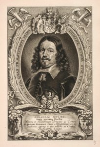
engraved oval portraits of men at bust length
cornelis galle (ii)
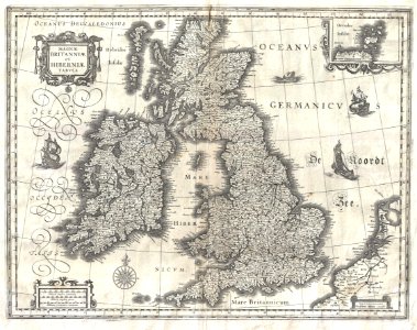
17th-century maps of the british isles
maps by willem and johannes blaeu
troianum regnum novem dinasteia complectens, priami dum regna manebant. adjecta sunt ea quae etiam innotuere posterioribus temporibus nomina - ex conatibus geographicis gulielmi nicolai sanson filii... - btv1b53179376g
guillaume sanson
maps of ancient israel by philippe de la rué
old maps of the united monarchy
william lee (valet)
noël le mire
old maps of the tribes of israel
old maps of ancient israel
german renaissance
1744 fleurons
prints by willem jacobsz. delff in the rijksmuseum amsterdam
latin-language mottos
album amicorum van jacobus heyblocq
anna maria van schurman
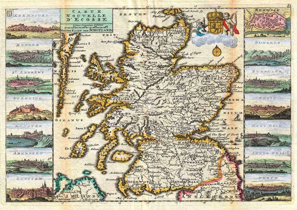
old maps of scotland
1747 maps
maps of ancient israel by philippe de la rué
old maps of the stations of the exodus
17th-century maps of rhineland-palatinate
maps by nicolaes visscher i
maps of seville by joris hoefnagel
bibliothèque nationale de france
maps of novaya zemlya
1590s maps
navigantium atque itinerantium bibliotheca
1744 fleurons
prints by willem jacobsz. delff in the rijksmuseum amsterdam
latin-language mottos
the knight's dream (antonio de pereda)
baroque
maps in the rijksmuseum amsterdam
18th-century maps of japan
mappa geographica novissima regni hungariae, - divisi in suos comitatus cum districtibus jazygum et cumanorum banatus temesiensis ejusque districtuum nec non regnorum croatiae sclavoniae dalmatiae magni... - btv1b532332906
tranquillo mollo
mappa geographica novissima regni hungariae, - divisi in suos comitatus cum districtibus jazygum et cumanorum banatus temesiensis ejusque districtuum nec non regnorum croatiae sclavoniae dalmatiae magni... - btv1b532332906
tranquillo mollo
mappa geographica novissima regni hungariae, - divisi in suos comitatus cum districtibus jazygum et cumanorum banatus temesiensis ejusque districtuum nec non regnorum croatiae sclavoniae dalmatiae magni... - btv1b532332906
tranquillo mollo
mappa geographica novissima regni hungariae, - divisi in suos comitatus cum districtibus jazygum et cumanorum banatus temesiensis ejusque districtuum nec non regnorum croatiae sclavoniae dalmatiae magni... - btv1b532332906
tranquillo mollo
mappa geographica novissima regni hungariae, - divisi in suos comitatus cum districtibus jazygum et cumanorum banatus temesiensis ejusque districtuum nec non regnorum croatiae sclavoniae dalmatiae magni... - btv1b532332906
tranquillo mollo
mappa geographica novissima regni hungariae, - divisi in suos comitatus cum districtibus jazygum et cumanorum banatus temesiensis ejusque districtuum nec non regnorum croatiae sclavoniae dalmatiae magni... - btv1b532332906
tranquillo mollo
mappa geographica novissima regni hungariae, - divisi in suos comitatus cum districtibus jazygum et cumanorum banatus temesiensis ejusque districtuum nec non regnorum croatiae sclavoniae dalmatiae magni... - btv1b532332906
tranquillo mollo
mappa geographica novissima regni hungariae, - divisi in suos comitatus cum districtibus jazygum et cumanorum banatus temesiensis ejusque districtuum nec non regnorum croatiae sclavoniae dalmatiae magni... - btv1b532332906
tranquillo mollo
mappa geographica novissima regni hungariae, - divisi in suos comitatus cum districtibus jazygum et cumanorum banatus temesiensis ejusque districtuum nec non regnorum croatiae sclavoniae dalmatiae magni... - btv1b532332906
tranquillo mollo
mappa geographica novissima regni hungariae, - divisi in suos comitatus cum districtibus jazygum et cumanorum banatus temesiensis ejusque districtuum nec non regnorum croatiae sclavoniae dalmatiae magni... - btv1b532332906
tranquillo mollo
mappa geographica novissima regni hungariae, - divisi in suos comitatus cum districtibus jazygum et cumanorum banatus temesiensis ejusque districtuum nec non regnorum croatiae sclavoniae dalmatiae magni... - btv1b532332906
tranquillo mollo
maps by abraham ortelius
pieter van der keere
drawings of coats of arms in the rijksmuseum amsterdam
drawings by jan brandes in the rijksmuseum amsterdam
prints by dirk jurriaan sluyter in the rijksmuseum amsterdam
etchings in the rijksmuseum amsterdam
bibliothèque nationale de france
guillaume sanson
maps of constantinople by braun & hogenberg
istanbul in the 1630s
maps of constantinople by braun & hogenberg
bibliothèque nationale de france
hieroglyphica, of, merkbeelden der oude volkeren (1735)
latin-language mottos
maps of paris from the david rumsey historical map collection
maps of paris by caspar merian
carte de l'amérique septentrionale by guillaume delisle (1700)
1700 maps of north america
english-language title pages
the botanist’s repository
prints by dirk jurriaan sluyter in the rijksmuseum amsterdam
etchings in the rijksmuseum amsterdam
jan huygen van linschoten
renaissance
a map of the british empire in america with the french and spanish settlements adjacent thereto
bibliothèque nationale de france
erasmus by hans holbein der jüngere (national gallery, london)
german renaissance,northern renaissance
maps by jodocus hondius
old maps of virginia
etchings in the rijksmuseum amsterdam
justus van den nypoort
prints of coats of arms in the rijksmuseum amsterdam
les images presque de tous les empereurs
maps by willem and johannes blaeu
1617 maps of africa
portrait prints in the rijksmuseum amsterdam
jean-baptiste colbert
1650s maps of the americas
1658 maps
18th-century double hemisphere world maps
1730s maps of the world
18th-century double hemisphere world maps
1730s maps of the world
prints by gaspar bouttats in the rijksmuseum amsterdam
latin-language mottos
geocentric model
1730 maps
maps by joachim bormeester
1680s maps of the world
maps by joachim bormeester
1685 maps
2701 - 2799 of 2,799
/ 28